looking at the components of cadastral survey system, it’s a loop that depends on each of other components. without the correct reinforcement of any single step, the survey system cannot be complete or functioning.
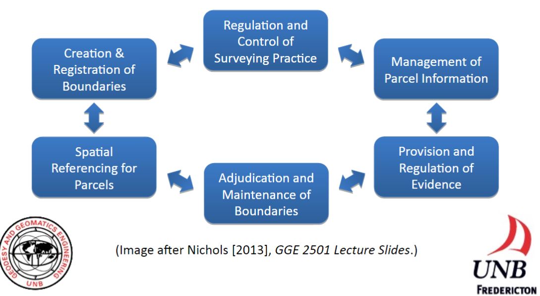
However, it’s harder to maintain the function of the system than it seems to be. this requires the cooperation from surveyors, land registry organizations (Land Title and Survey Authority), law enforcement (lawyer) and property owners. Regulation and control of surveying practice relies on land registry organization as well as professional surveyor’s organization. by setting up standards and regulations (such as survey practice act) to be practiced by surveyors, quality assurance will be implemented. Management of parcel information also requires setting up database by
land registry organization (Parcel Map BC as example). This includes constantly updating parcel information from surveyors, and data management from land title office.
Provision and regulation of evidence also requires the joint effort from surveyors and land title office. By regulating the standards for survey monumentation, surveyor should follow the standards and provide accurate information to the geo-spatial map and survey monument network. Maintaining the boundary needs the property owners to be aware of the importance of keeping boundary clear, and hiring professional land surveyor to locate the correct boundary. Also, government department may need to keep track of the boundary history and update information as required (National resources Canada).
Parcel information as to be tied to the spatial network that’s established by the city (survey control network), and once it’s settle, boundary can be defined and registered in land title system.
these are just the thoughts with previous experience at work. the system needs everyone who plays a part in it to contribute to run its full function.
